NASA’s Mars Curiosity rover explores ‘Yellowknife Bay’
NASA
PASADENA, Calif. – After imaging during the holidays, NASA’s Mars rover Curiosity resumed driving Jan. 3, 2013 and pulled within arm’s reach of a sinuous rock feature called “Snake River.”
Snake River is a thin curving line of darker rock cutting through flatter rocks and jutting above sand. Curiosity’s science team plans to get a closer look at it before proceeding to other nearby rocks.
“It’s one piece of the puzzle,” said the mission’s project scientist, John Grotzinger of the California Institute of Technology in Pasadena. “It has a crosscutting relationship to the surrounding rock and appears to have formed after the deposition of the layer that it transects.”
The drive during the mission’s 147th Martian day, or sol, on the Red Planet took Curiosity about 10 feet (3 meters) northwestward and brought the mission’s total driving distance to 2,303 feet (702 meters). The rover is within a shallow depression called “Yellowknife Bay,” which is a flatter and lighter-toned type of terrain from what the mission crossed during its first four months inside Gale Crater.
During a holiday break for the rover team, Curiosity stayed at a location within Yellowknife Bay from which the rover took images of its surroundings. The team is evaluating possible first targets for use of Curiosity’s hammering drill in coming weeks. The drill will collect powdered samples from the interior of rocks for analysis by instruments inside the rover.
“We had no surprises over the holidays,” said the mission’s project manager, Richard Cook of NASA’s Jet Propulsion Laboratory, Pasadena. “Now, Curiosity is back on the move. The area the rover is in looks good for our first drilling target.”
NASA’s Mars Science Laboratory Project is using Curiosity to assess whether areas inside Gale Crater ever offered a habitable environment for microbes. JPL, a division of Caltech, manages the project for NASA’s Science Mission Directorate in Washington.
__________________________________________
Click images to enlarge
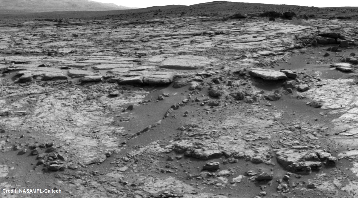
At Edge of ‘Yellowknife Bay,’ Sol 130
In a shallow depression called “Yellowknife Bay,” the NASA Mars rover Curiosity drove to an edge of the feature during the 130th Martian day, or sol, of the mission (Dec. 17, 2012) and used its Navigation Camera to record this view of the ledge at the margin and a view across the “bay.”
NASA’s Jet Propulsion Laboratory, a division of the California Institute of Technology in Pasadena, manages the Mars Science Laboratory mission for NASA’s Science Mission Directorate in Washington. The mission’s Curiosity rover was designed, developed and assembled at JPL.
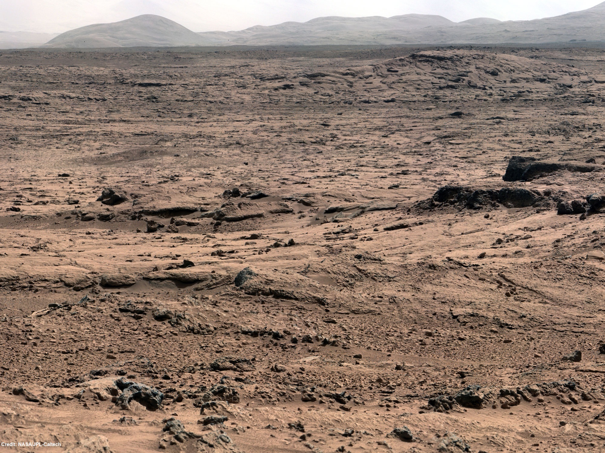
Looking Back at Entry Into ‘Yellowknife Bay’
The NASA Mars rover Curiosity used its left Navigation Camera to record this view of the step down into a shallow depression called “Yellowknife Bay.” It took the image on the 125th Martian day, or sol, of the mission (Dec. 12, 2012), just after finishing that sol’s drive. The Sol 125 drive entered Yellowknife Bay and covered about 86 feet (26.1 meters). The descent into the basin crossed a step about 2 feet (half a meter) high, visible in the upper half of this image.
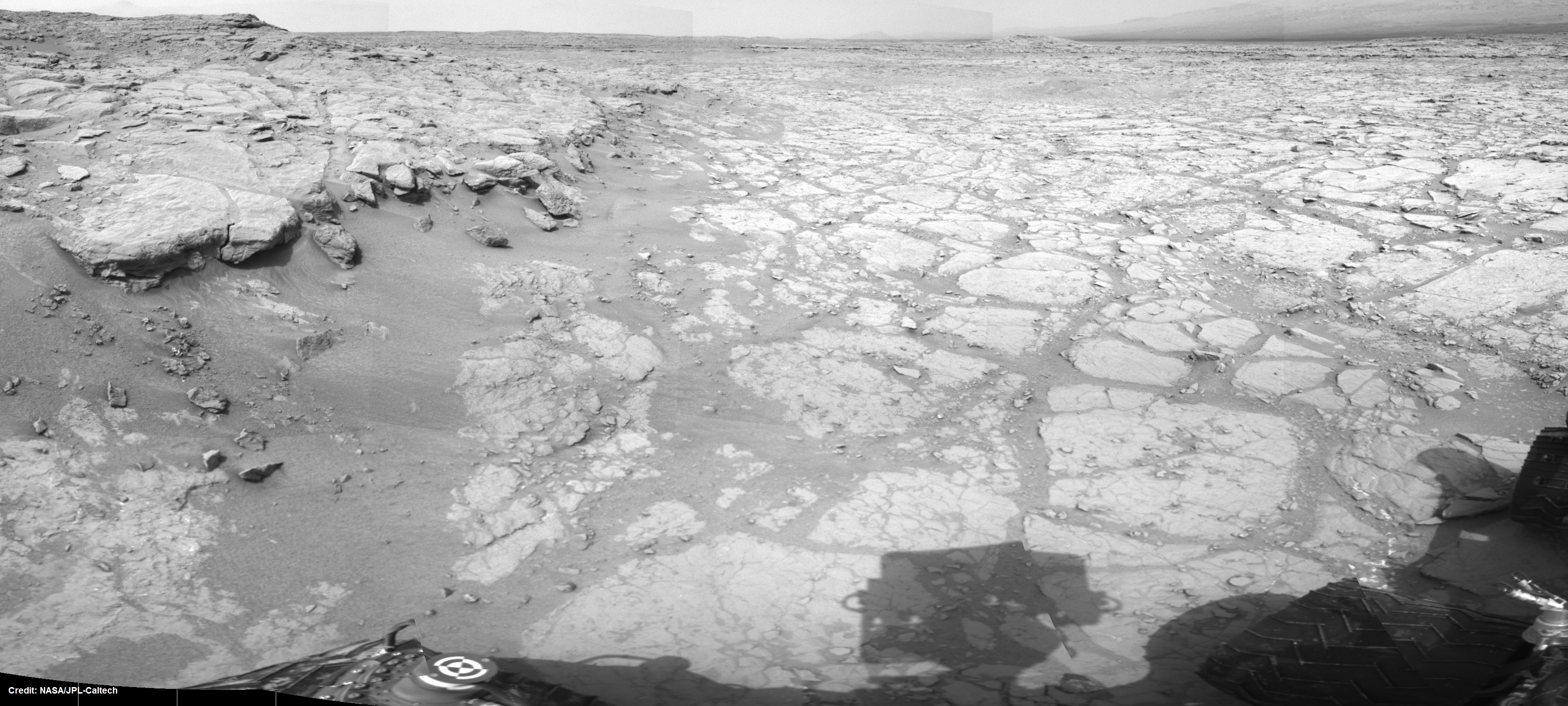
‘Snake River’ Rock Feature Viewed by Curiosity Mars Rover
The sinuous rock feature in the lower center of this mosaic of images recorded by the NASA Mars rover Curiosity is called “Snake River.” The images in the mosaic were taken by Curiosity’s Navigation Camera during the 133rd Martian day, or sol, of the rover’s mission on Mars (Dec. 20, 2012).
On Sol 147 (Jan. 3, 2013), Curiosity drove about 10 feet (3 meters) to get a closer look at Snake River for before proceeding to other nearby rocks.


January 7, 2013
World culture/events